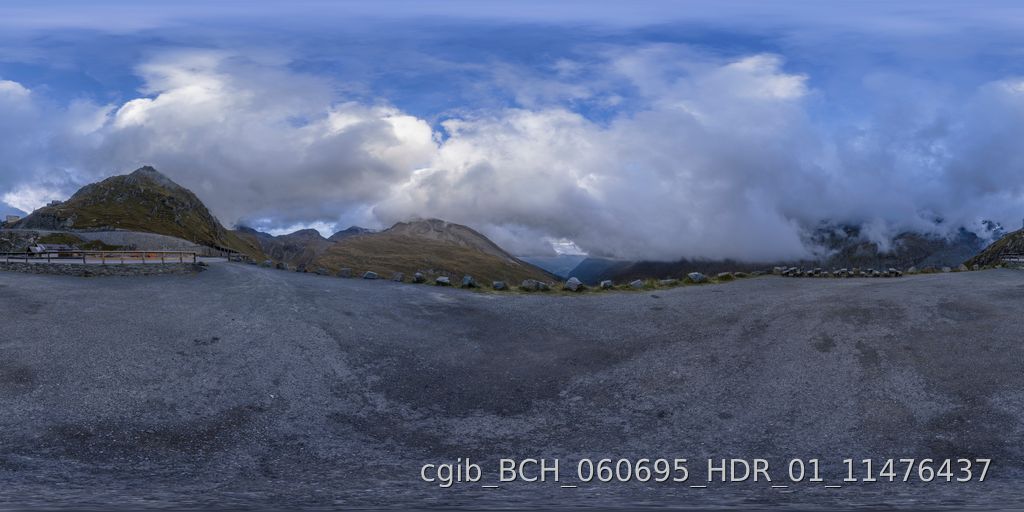
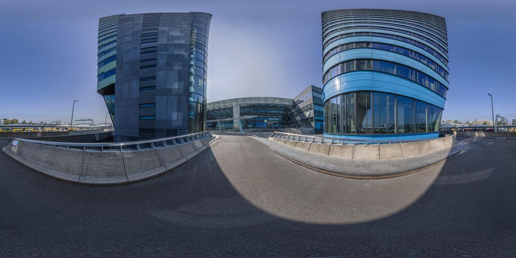
An HDRi Map is a 360-degree image that includes lighting information as well as visuals. You can think of an HDRi Map as a digital photographic scan of a place. For that reason, HDRi maps are also sometimes called HDRi environments.
HDRi stands for High Dynamic Range Image. A well-produced HDRi map captures both a visual representation of a place–either a physical place in the real world or a virtual one created with CG–and all the information that a 3D designer and artists would need to light a scene accurately.
HDRi maps are a versatile tool in the 3D design space. They’re used for everything from virtual product photography , to architectural visualization, to digital twins and remote site visits.
Let’s take a deeper look at HDRi maps, how they’re produced, what they’re used for, and how you can access them.
Need professional HDRi maps for free? Sign up for our Free tier and get one premium HDRi map per month from our collection.
How Does HDRi Lighting Work?
When a professional photographer captures a HDRi Map from a real-world place, they capture detailed lighting data about the scene surrounding their camera.
In a typical photo that you might see on a website or your phone, each pixel is represented by a color and a brightness value. The brightness values range from 0 to 255. In this context, that range of brightness values is called the image’s dynamic range.
That’s helpful for viewing photos on a screen. But in the real world, brightness values span a much larger range of levels than 0-255. In a traditional image, much of that additional real-world lighting data is lost. The dynamic range is limited.
In an HDRi map, in contrast, the photographer captures lighting values for each pixel that span a range of thousands or even millions of different levels instead of just 255. That means an HDRi map faithfully captures far more lighting information about a scene than a traditional image.
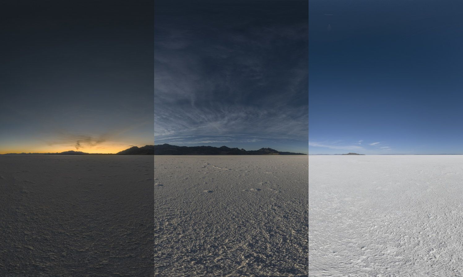
The dynamic range that fits into an HDRi file is wider than your computer monitor can display. Images with a wide dynamic range will result in visually over-blended and very dark areas if you view them without any Tone-Mapping applied.
Using Additional Lighting Data
Again, phone screens and most computer monitors can only show a limited range of brightness values. So what is the extra lighting data in an HDRi environment used for?
When HDRi maps are used for 3D rendering, the additional lighting data stored in each pixel becomes a powerful tool. The lighting data can be used to accurately light a 3D model placed in the virtual environment of an HDRi map.
Imagine, for example, that a photographer captures an HDRi Map of a coastal road . A car designer wants to visualize her newest vehicle driving on that road.
The designer can place a 3D model of her newly-designed car into the HDRi Map. The 360 HDRi Map will surround the car, creating the impression that the car is in the scene.
But it will do something else, too. Because the HDRi Map captures an incredible range of lighting data about each pixel, our designer can use that data to light the 3D model of her car as if it was really driving on the road.
The exact color of the sky, any reflections that would be present on a real object, and more are all captured by the HDRi map’s lighting data.
That’s a powerful capability. It frees up 3D designers and artists to focus on telling their brands’ stories rather than having to worry about manually tweaking lighting. It also allows designers to rapidly change a scene without having to make hours worth of updates to lighting values.
The process of using HDRi map information to light a scene is called Image Based Lighting.
Uses for HDRi Maps
How are HDRi maps and HDRi environments actually used in the real world? These powerful visual tools are used in a wide variety of industries.
Automotive Rendering
As our example above suggests, HDRi environments are often used in the automotive space.
Car companies often want to visualize hundreds of variations of a single vehicle model in a specific scene. Flying a camera crew to a physical location, along with vehicles in a wide range of paint colors and trim levels, would be prohibitively expensive.
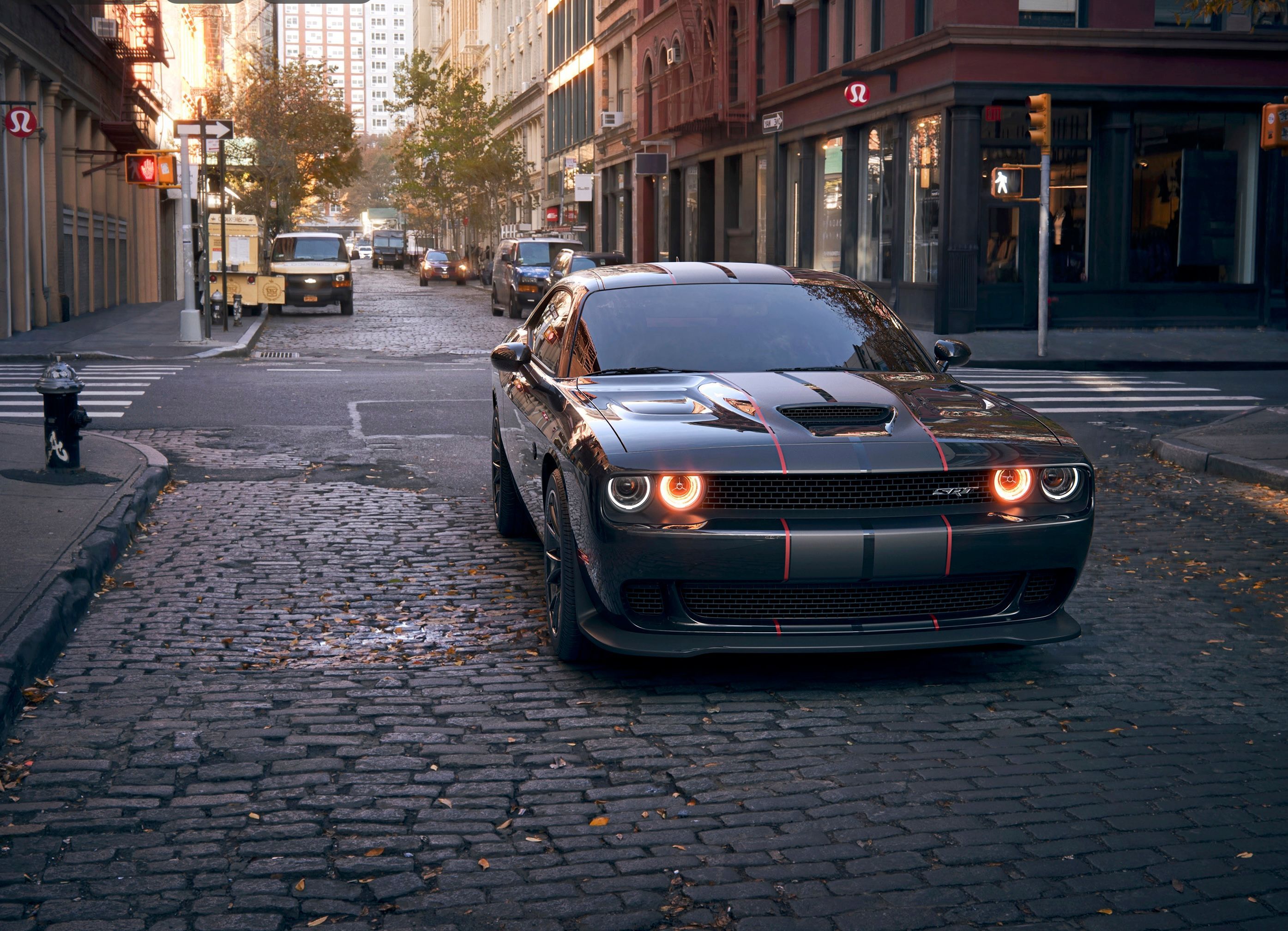
Many car companies even use these kinds of virtually-produced images for television commercials or print advertisements. A professional 3D designer can use high-quality HDRi images to create a photorealistic vehicle render.
Want to see an example? Allan Porthilo’s render of a Dodge Challenger looks completely real, yet was produced using a 3D model in an HDRi environment.
Architectural Visualization
Architects have always created models of their buildings before embarking on an actual construction project. Models bring their ideas to life, allowing clients to see exactly how a proposed building will look.
Today, many architects use 3D modeling tools to visualize their future buildings. There’s an issue, though. Buildings can’t be separated from the real-world environments they will one day occupy. Visualizing them well requires situating 3D building models in a virtual environment.
Architects often use HDRi maps for this purpose . Placing a virtual building model in an HDRi virtual environment provides visual context for the proposed building. It also lets architects automate time-consuming tasks, such as providing visuals for the windows or the surounding environment in renderings of their buildings’ interiors.
The detailed lighting data in an HDRi map is helpful for architects, too. Importing the lighting data from an HDRi Map–with or without the visuals–lets them choose the perfect real-world lighting to apply to their virtual building models.
Virtual Production
Shooting a commercial or a television show on-location is expensive and time-consuming. It also creates massive amounts of carbon emissions.
Even building detailed physical sets in a studio environment can be costly and challenging. Lighting a scene accurately is tough, and getting accurate lighting and visuals within a studio often requires extensive post-processing.
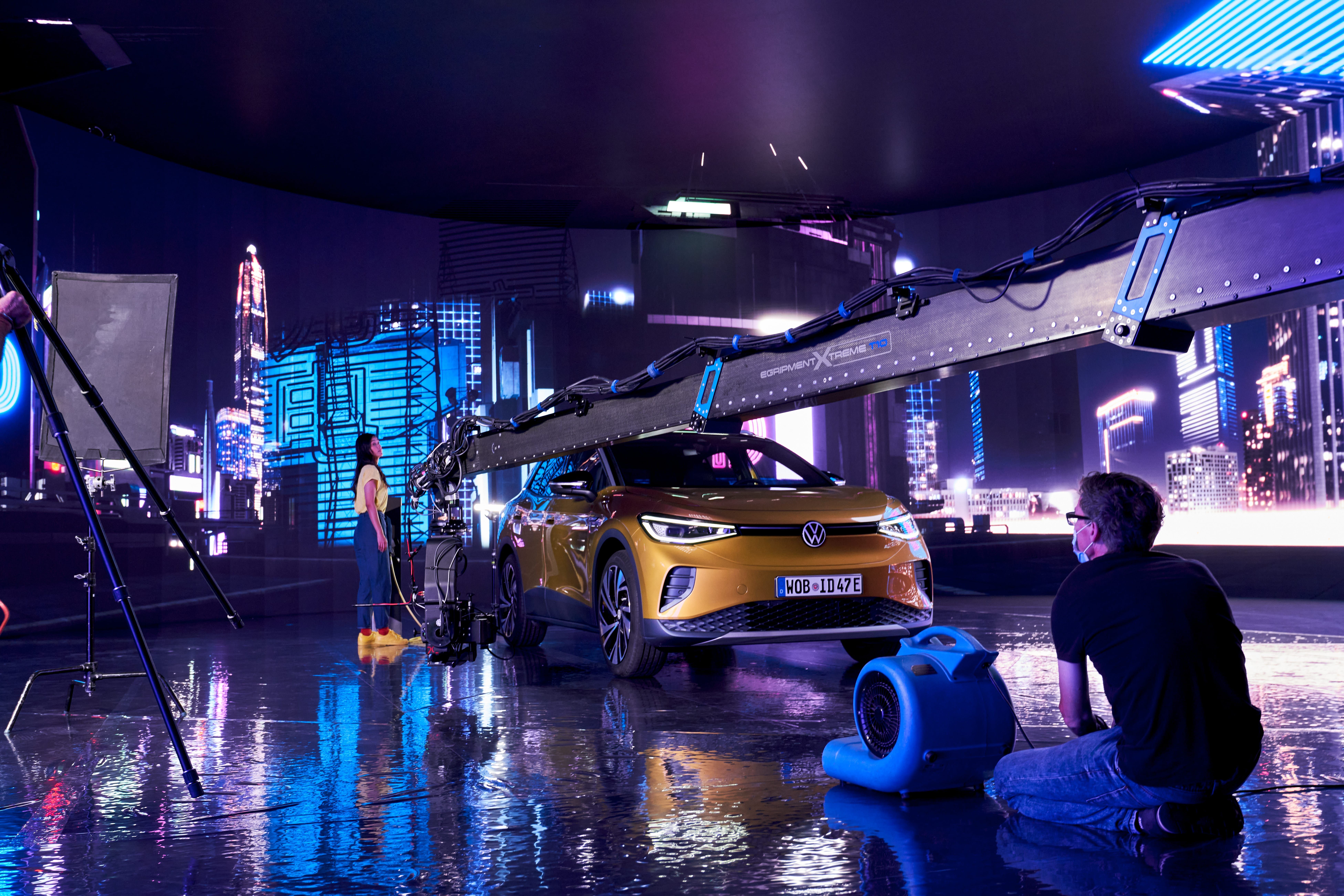
Actors can play out their scene in front of the LED wall. The visuals look realistic , and the HDRi map displayed on the wall lights the actors and props realistically. This technique cuts costs, post-processing time, and CO2 emissions.
In some cases, virtual production can reduce the carbon emissions of a large production by 90% or more.
What is HDRi vs HDR?
If you work in the photography space, you may have seen the term HDR used before. Confusingly, the term HDR and the term HDRI mean different things in the photography industry and the computer graphics industry.
In photography, an HDR image usually refers to an image that has been captured with a high dynamic range but is later transformed through tone-mapping into a standard 8-bit image with a normal dynamic range but showing all details that were visible to the human eye.
In an interior photograph taken with a normal camera, if the interior is exposed correctly, the outside world would often be overexposed.
By capturing a wide set of brackets to cover the full dynamic range and later combining them into one HDR Image–then tone-mapping and exporting the image–photographers can achieve any exposure that they need.
These HDR images are often used in fields like real estate photography. Capturing an HDR image lets photographers ensure even lighting across an entire scene, even if parts of the scene would normally be brightly lit and others would be in shadow.
The technique is so common that it is now used in many consumer devices, including the iPhone.
In contrast, a HDRi Map doesn’t simply use extra brightness data to create an even exposure. Instead, the pixels in an HDRi map retain their high dynamic range, allowing a HDRi Map to be used for image-based lighting and other advanced rendering techniques.
Making HDRi Maps
Making true, professional-grade HDRi maps is a complex process. Although apps exist that allow hobbyists to capture their own HDRi environments, the results often don’t have the resolution, quality and lighting data needed for pro-quality rendering.
Creating HDRi maps that are sufficiently high quality for big brands like Mercedes or Volkswagen requires pro-quality camera gear and extensive training.

You can read more about how we create HDRi maps here. For a detailed explainer about creating your own HDRi maps, we recommend this article.
Download our HDRi Maps
Need a pro-quality HDRi map with 450+ megapixels of resolution and full lighting data for your next render? Again, you could learn to capture one yourself. But you can also let us do the work for you and download an HDRi map from our collection of over 7,000 locations.
CGI.Backgrounds has produced premium HDRi maps for 18+ years, and we work with the world’s leading brands and creative agencies.
You can purchase a subscription to access our HDRi maps , buy them al-la-carte, or sign up for our Free tier, which is perfect for hobbyists and students who are just starting out with 3D rendering.
Conclusion
HDRi maps are a powerful tool for 3D designers and artists who need to create realistic virtual environments. Although they can be challenging to create, HDRi maps let 3D designers light scenes accurately, reduce their production costs, and cut their climate impact.
