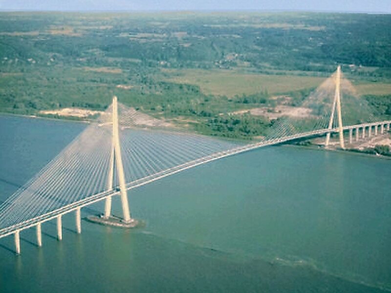
The Pont de Normandie is a cable-stayed road bridge that spans the river Seine linking Le Havre to Honfleur in Normandy, northern France. Its total length is 2,143.21 metres – 856 metres between the two piers. It is also the last bridge to cross the Seine before it empties into the ocean. Despite being a motorway toll bridge, there is a footpath as well as a narrow cycle lane in each direction allowing pedestrians and cyclists to cross the bridge free of charge.
Download Download See moreWikipedia https://en.wikipedia.org/wiki/Pont_de_Normandie
Official Website https://www.pontsnormandietancarville.fr/
Address A29, 14600, France
Coordinates 49°25'59.128" N 0°16'25.856" E