NOAA doubles the chances for a nasty Atlantic hurricane season due to warm ocean temps
The Aug. 10 update from NOAA increases the potential number of tropical systems that the Atlantic Basin could see to around or above average.
Share:
More Stories
1:53

News 12 beats the heat today at Long Branch beach
1h ago2:07
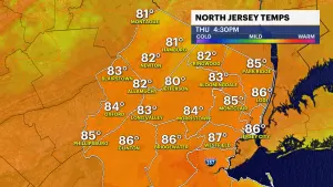
Summer feeling today in New Jersey with temps in the mid-80s; cooler weather arrives Friday
3h ago1:06

LIVE BLOG: News 12 weather updates
5h ago2:07
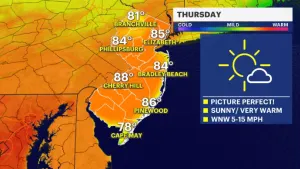
Beautiful Thursday weather ahead; clouds and rain develop by the weekend
13h ago2:07
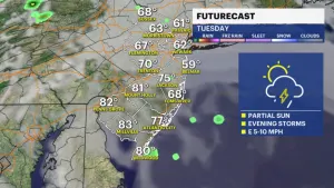
STORM WATCH: Tracking evening thunderstorms expected to impact New Jersey
yesterday2:07
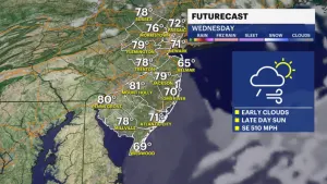
Pop-up rain showers expected tonight into Tuesday morning
2ds ago1:53
News 12 beats the heat today at Long Branch beach
1h ago2:07
Summer feeling today in New Jersey with temps in the mid-80s; cooler weather arrives Friday
3h ago1:06
LIVE BLOG: News 12 weather updates
5h ago2:07
Beautiful Thursday weather ahead; clouds and rain develop by the weekend
13h ago2:07
STORM WATCH: Tracking evening thunderstorms expected to impact New Jersey
yesterday2:07
Pop-up rain showers expected tonight into Tuesday morning
2ds agoThe National Oceanic and Atmospheric Administration has released an updated hurricane season forecast about halfway through the season.
The East Coast typically sees tropical storms, with more intense storms such as hurricanes and major hurricanes not impacting the area as much.
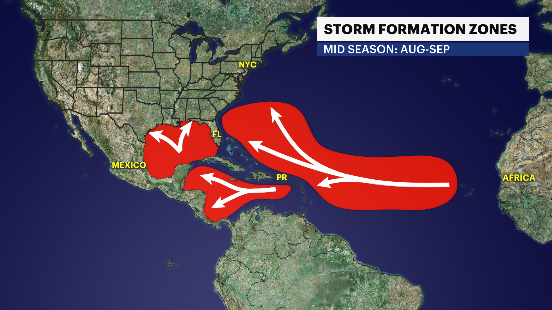
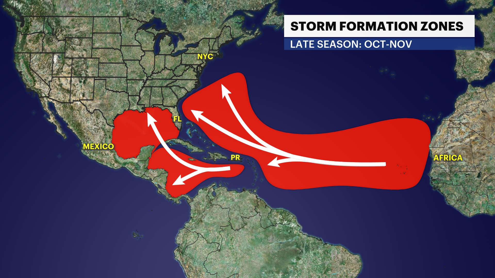
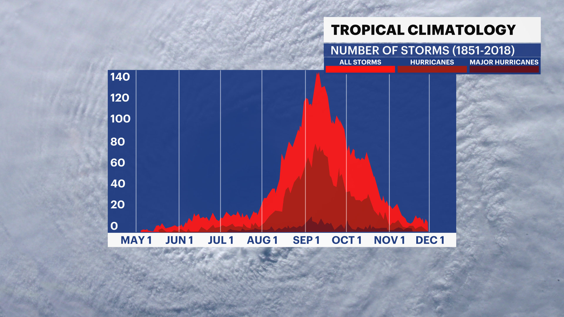
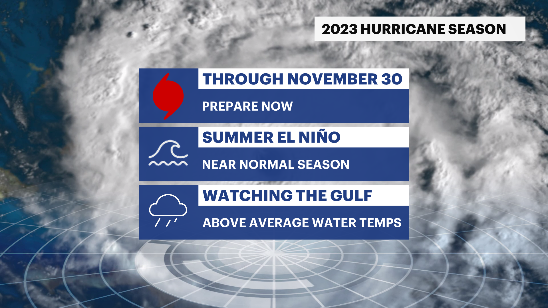
Hurricane season peaks on Sept. 10 and officially goes through Nov. 30. New Jersey typically sees most tropical activity in September or October.
The Aug. 10 update from NOAA increases the potential number of tropical systems that the Atlantic Basin could see to around or above average.
NOAA says the increase can be attributed to warm water temperatures in the Atlantic Ocean, Gulf of Mexico and Caribbean Sea.
The continued record-warm temperatures in the North Atlantic, which is connected to climate change, is a key factor in increasing the prediction because it is hotter and lasted longer than initially expected, according to Matthew Rosencrans, lead hurricane season forecaster with NOAA’s Climate Prediction Center.
Hot water is fuel for hurricanes, with the storms sucking up the heat energy from the water. The storm gets more humid, moist and stronger.
There have been four named tropical systems this season. Arlene, Bret and Cindy were all tropical storms. Don briefly became a hurricane.
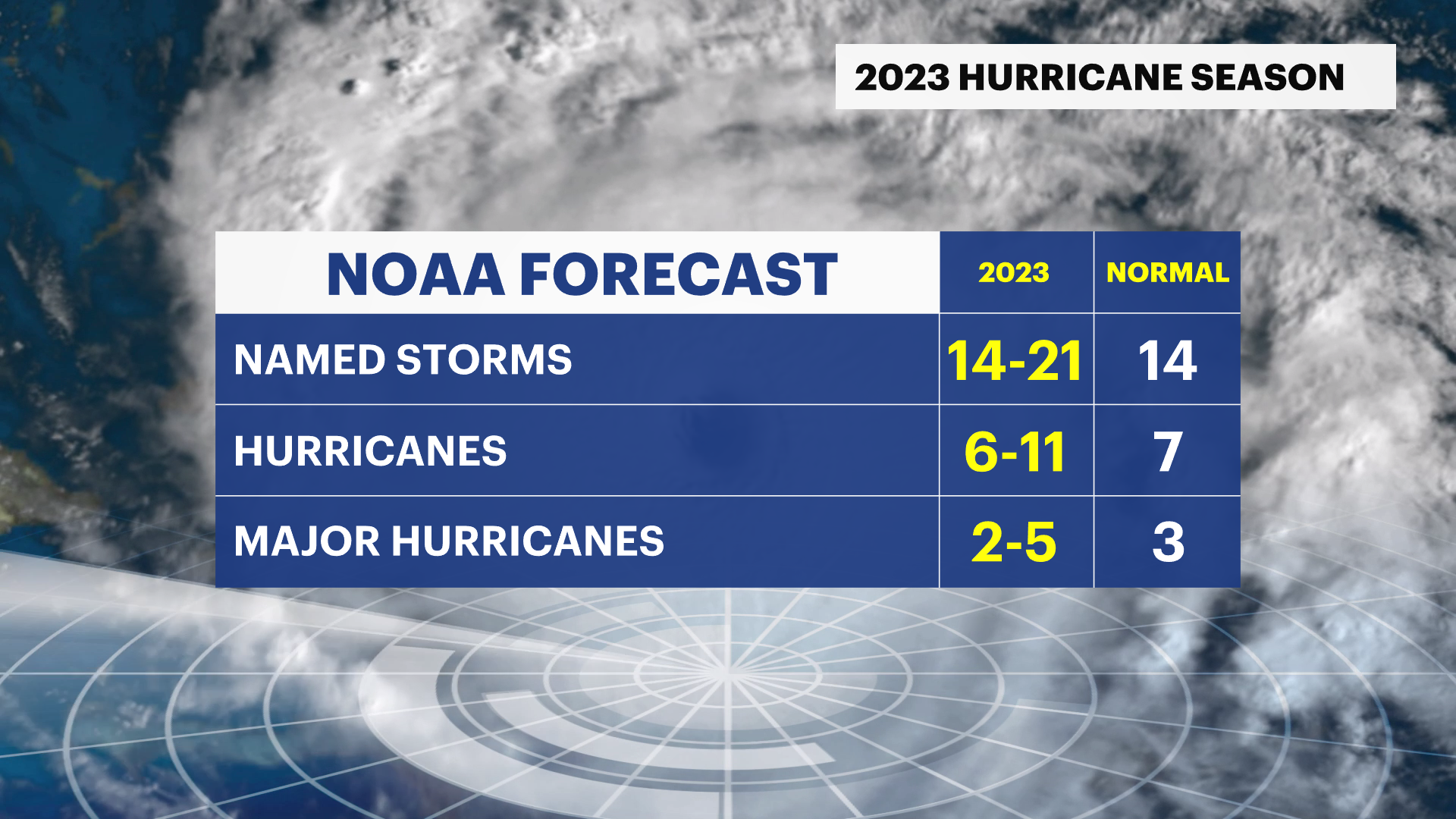
NOAA is now predicting 14-21 named storms for the Atlantic Basin for the rest of hurricane season. The average is typically 14 storms.
The National Hurricane Center now has a forecast of six to 11 hurricanes compared to the average of seven. There is the potential for two to five major hurricanes, compared to the average of three.

The Associated Press wire services contributed to this report.